The word 둘레길 — Seoul’s famous circular trail system — conjures images of easy Sunday strolls, gentle slopes, and park benches. So when a friend visiting Seoul from the US suggested doing Seoul Trail Course 2 hiking guide territory for the day, her group figured it would be a relaxed morning. Within the first 100 metres, the trail climbed sharply uphill and didn’t apologise. If you want other great ways to spend a weekend outdoors in Seoul, the Han River Starlight Cruise is a very different kind of adventure — but Course 2 is the one that earns its view.
- → What Is Seoul Trail Course 2?
- → Getting There by Subway
- → Trail Difficulty: What the Brochure Doesn’t Say
- → The Stamp Collection Experience
- → The Views That Make It Worth It
- → Royal Azalea Hill: The Finish Line
- → What to Wear and Bring
- → Practical Info & Map
📌 Quick Summary:
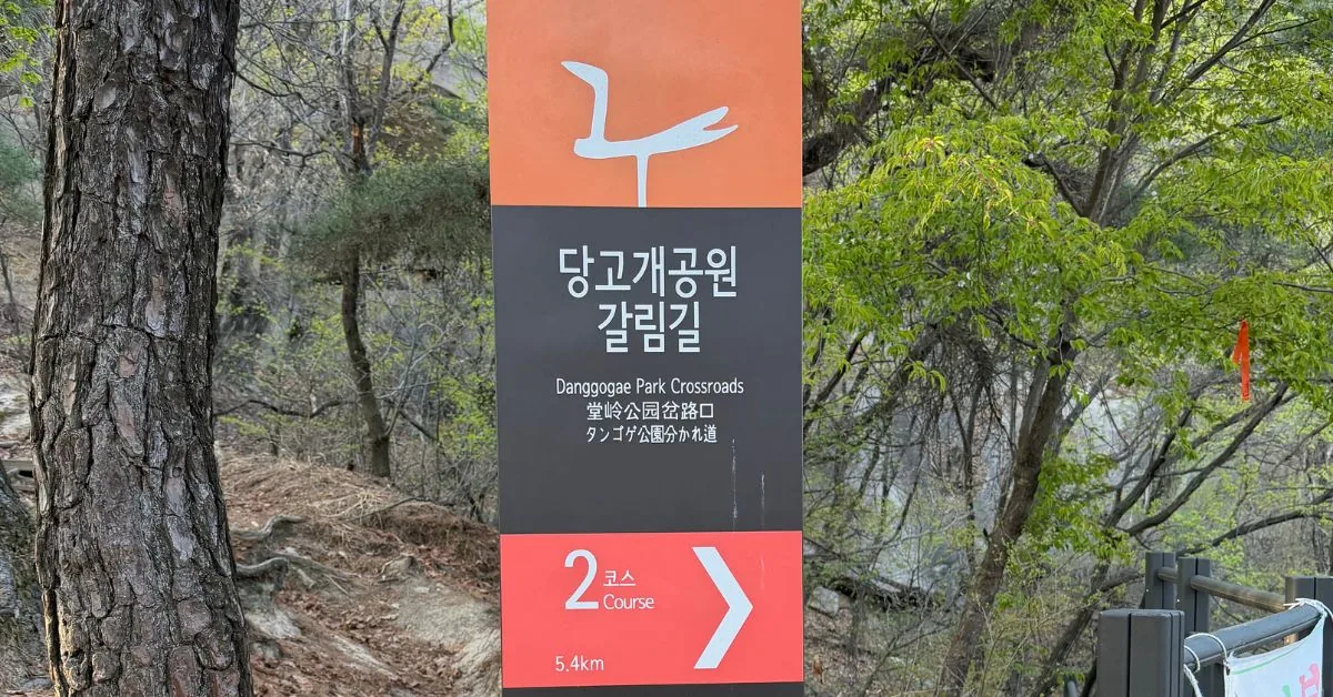
Course 2 runs 5.4km from Danggogae Park Fork to Sanggye-dong Royal Azalea Hill. Elevation gain of 490m. Rated difficult — one of only 4 courses on the Seoul Trail with that rating. Fully accessible by subway Line 4. Free to hike. Stamp stations at two points along the route. Allow 2 hours 50 minutes minimum.
What Is Seoul Trail Course 2?
The Seoul Trail is a 156.6km circular hiking network wrapping around the outer mountains of the city, divided into 21 courses. Course 2 — nicknamed the Deongneunggogae section — runs along the ridge between Suraksan and Bullamsan mountains, connecting Nowon-gu in Seoul to the edges of Namyangju. The trail’s theme is officially described as an “ecological path connecting city and nature.” That sounds peaceful. The reality is steep forest, exposed rocky sections, and a climb that catches most people off guard.
The course earns its difficulty rating of “상” (hard) — shared by only 3 other courses across the entire Seoul Trail network. Don’t let the city backdrop fool you into thinking this is a park walk.

Getting There by Subway — No Car, No Korean Needed
This is one of Course 2’s genuine strengths. The trailhead sits within walking distance of Danggogae Station, Seoul Subway Line 4. Exit 3 for the start point, Exit 1 when you finish. Wherever you are in Seoul or Gyeonggi, you can get here on public transport. From the station, open KakaoMap or NaverMap, search 당고개공원, and follow the walking route to the entrance. Signboards at the trailhead are posted in multiple languages — you won’t get lost finding the start.
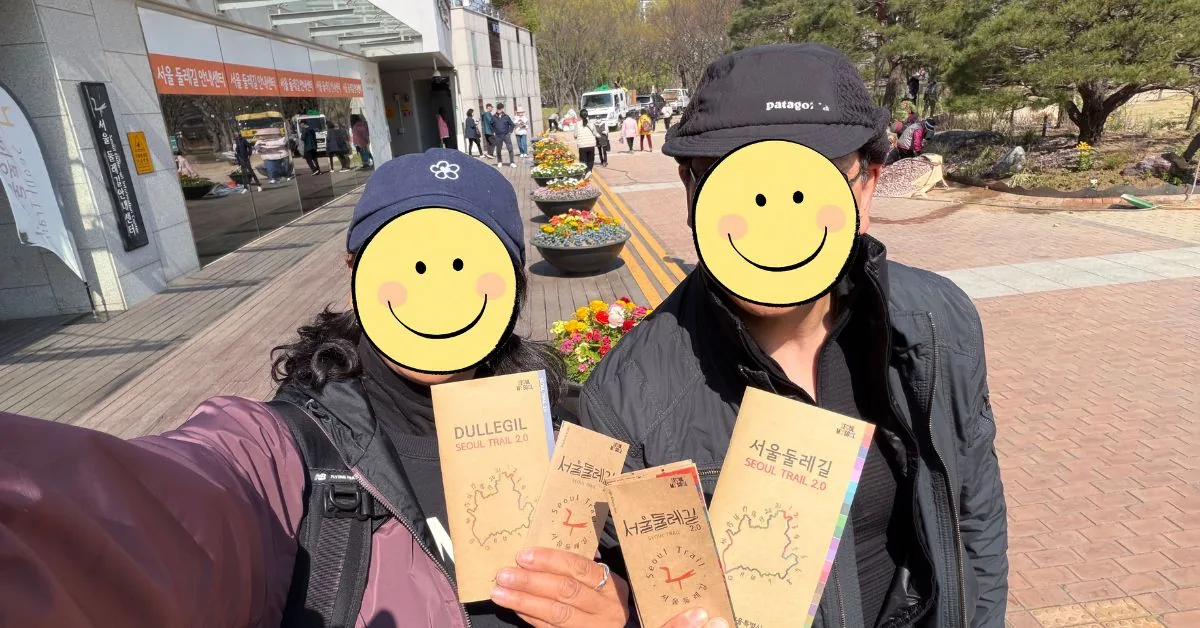
💡 Pro Tip:
Grab a physical Seoul Trail map pamphlet near the station entrance before you head in. They’re free and useful if your phone battery dies mid-trail.
Seoul Hiking for Expats: Trail Difficulty & What the Brochure Doesn’t Say
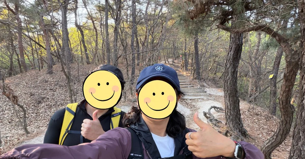
The honest version: the uphill starts immediately. Not gradually — immediately. Within the first 100 metres the path tilts steeply and your heart rate responds. My friend, who had been living in the US and came back to Korea for a month, went in expecting a casual morning out with friends. She got a proper workout instead.
This is the central trap of the 둘레길 label. In Korean, 둘레길 literally means a path that goes around the perimeter — and most people associate it with flat, accessible walking routes. Course 2 is a hiking trail with mountain-grade elevation. The total ascent is 490m over 5.4km. There are sections where you’re scrambling over rock faces, not strolling through forest. The hardest stretch is the climb from Danggogae Park up to the first stamp station — a sustained uphill push that makes your legs remember it the next day.
That said — doable. Absolutely doable. You don’t need to be a serious hiker. You just need to not underestimate it.
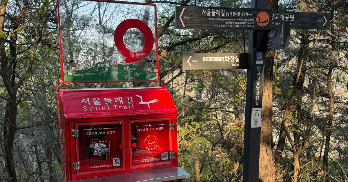
Korea Trail Stamp Collection: The Red Mailboxes
One of the more charming features of the Seoul Trail system is the stamp passport. Along the route, you’ll find distinctive red mailbox-shaped stamping stations where hikers press an ink stamp into their trail booklet to record their progress. Course 2 has two stamp points: one at the Danggogae Park Fork, and one at the Royal Azalea Hill finish area.
My friend stamped her book at the station along the way. Whether she’d collected stamps on other courses before, I’m not sure — but the stamp system is a satisfying way to mark progress, especially if you’re working through multiple Seoul Trail courses over time. Stamp booklets are available for free at the trailhead.
💡 Pro Tip:
The stamp stations are inside distinctive red mailbox-style boxes on wooden platforms. Keep an eye out — they can be easy to miss if you’re moving fast.
The Views That Make It Worth It
Somewhere after the hard climb, the trees open up and northern Seoul spreads out below you. This is the moment. My friend said this was the part that got her — the realisation that Seoul, this massive urban tangle of apartments and highways, is actually ringed by proper mountains with proper views. She hadn’t expected to be genuinely hiking inside the city limits.
The rocky outcrops along the ridge make for natural rest points. Sit down, catch your breath, look out. The contrast between the dense city below and the silence of the forest around you is the kind of thing that makes you understand why Koreans take their hiking culture so seriously.


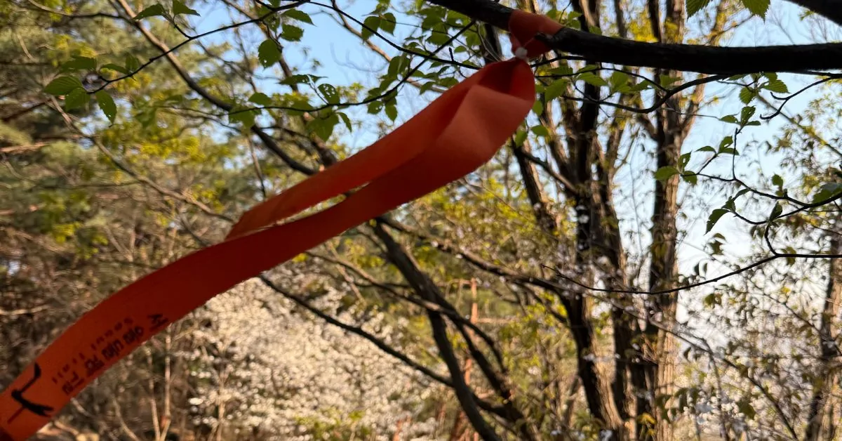
Navigating the Trail: Follow the Orange Ribbons
The Seoul Trail is marked with bright orange guide ribbons tied to tree branches at regular intervals. In the forested sections where the path splits or becomes unclear, these ribbons are your navigation system. Keep them in sight and you won’t go wrong. The Danggogae Park crossroads has a traditional wooden signpost pointing toward multiple destinations — that junction is where a lot of first-timers pause and second-guess themselves. Follow the ribbon, trust the sign.
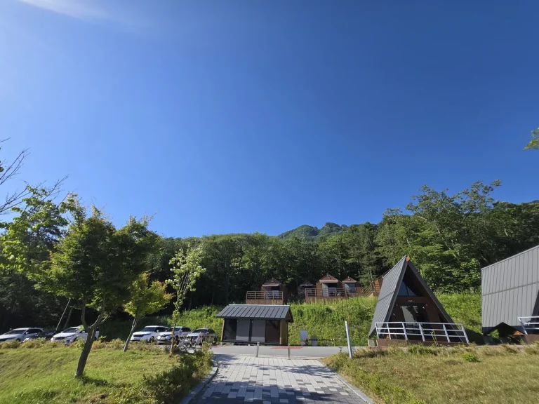
Royal Azalea Hill: The Finish Line
Course 2 ends at Sanggye-dong Outing Royal Azalea Hill — a scenic overlook area with a cluster of azalea bushes and a clear sightline to Bullamsan’s summit. In spring, when the azaleas bloom pink and purple across the hillside, this finish point is genuinely beautiful. My sister lives near this area and confirms the bloom season is worth planning a visit around.
A note for anyone who’s heard of the Bullamsan Azalea Festival: that event takes place at a different azalea garden on Course 3, not here. This spot is quieter, less crowded, and arguably more rewarding precisely because you earned it on foot.

For a completely different kind of Seoul day out — one that involves zero uphill — you might also enjoy checking out other fun things to do with friends visiting Korea, like catching a V-League volleyball match in the city.
💡 Pro Tip:
The azalea bloom on Course 2 typically peaks in mid-to-late April. Time your hike for a weekend during that window and the finish line becomes something genuinely special.
What to Wear and Bring
This matters more than people think. Course 2 is not a park path — it’s a mountain trail with rocky sections and sustained climbs. Show up underprepared and you’ll feel it.
- Shoes: Enclosed, grippy-soled shoes minimum. Proper hiking shoes or trail runners are better. Sandals or fashion sneakers are a bad idea.
- Hat: The trail gets full sun on exposed sections. A cap or sun hat is essential, especially in summer. There have also been reports of caterpillars in the trees — a hat keeps them off you.
- Sunscreen: Apply before you start. You’ll be sweating too much to reapply mid-trail.
- Water: Bring more than you think you need. There are no convenience stores on the trail.
- Clothing: Breathable, sweat-wicking layers. You’ll heat up fast on the first climb and cool down quickly if you stop at the top.
I did an unplanned trail in Osan recently with my wife and our baby — steep, hard, and we weren’t ready for it. Lesson learned the direct way. For Course 2, go in with a plan.
📍 Danggogae Park — Seoul Trail Course 2 Start
Address: 305 Sanggye-ro, Nowon-gu, Seoul, South Korea
Not Sure How to Navigate Korea on Your Own?
From figuring out trail access to getting around Seoul without a word of Korean — JustAskJin is a concierge service built specifically for expats in Korea. Whether you need help planning a day out, sorting documents, or just knowing what to do next, we’ve got you covered.